Now Reading: Understanding Global Position Coordinates: Your Guide to Navigating the World
-
01
Understanding Global Position Coordinates: Your Guide to Navigating the World
Have you ever wondered how your phone knows exactly where you are? Or how a package finds its way to your doorstep from across the country? The magic behind it all is a system known as global position coordinates. This powerful tool has transformed how we navigate, explore, and connect with the world around us. It’s the invisible grid that maps our entire planet, allowing any point to be identified with incredible accuracy.
This system isn’t just for pilots and ship captains anymore. It’s integrated into our daily lives, from the GPS in our cars to the location tags on our photos. In this guide, we’ll break down everything you need to know about global position coordinates. We will explore how they work, why they are so important, and the different ways they are used every single day. Get ready to uncover the science of location and see our world in a whole new way.
Key Takeaways
- Global position coordinates are a system using latitude and longitude to pinpoint any location on Earth.
- Latitude lines run horizontally (east-west) and measure distance north or south of the Equator.
- Longitude lines run vertically (north-south) and measure distance east or west of the Prime Meridian.
- The Global Positioning System (GPS) is the most common technology used to determine these coordinates via satellites.
- This system is vital for navigation, emergency services, scientific research, and countless everyday applications like ride-sharing and food delivery.
What Exactly Are Global Position Coordinates?
At its core, the concept of global position coordinates is a way to give every single spot on Earth a unique address. Think of it like a giant, invisible graph paper laid over the entire globe. This grid system uses two main measurements to find any location: latitude and longitude. By combining these two values, we can pinpoint a location with remarkable precision, whether it’s a bustling city square or a remote mountain peak.
Latitude lines, also called parallels, run horizontally around the Earth, parallel to the Equator. The Equator itself is the starting line, marked as 0° latitude. From there, latitude measures how far north or south a location is, up to 90° North (the North Pole) or 90° South (the South Pole).
Longitude lines, also known as meridians, run vertically from the North Pole to the South Pole. The starting line for longitude is the Prime Meridian, which runs through Greenwich, England, and is marked as 0° longitude. Longitude measures how far east or west a location is from this line, up to 180° in each direction. When you put a latitude value and a longitude value together, you get a unique set of global position coordinates that marks one specific spot on the planet.
The Foundation: Latitude and Longitude Explained
To truly grasp how global position coordinates work, we need to look closer at their two fundamental components: latitude and longitude. They are the building blocks of our global mapping system.
Understanding Latitude: The Horizontal Lines
Latitude measures a point’s distance from the Equator. Imagine slicing the Earth horizontally like an onion. The Equator is the biggest slice right in the middle, at 0 degrees. Every line north of the Equator is given a positive degree value, and every line south is given a negative value (or designated with “N” or “S”).
- Equator: 0° latitude. This imaginary line divides the Earth into the Northern and Southern Hemispheres.
- Tropics: The Tropic of Cancer is at 23.5° North, and the Tropic of Capricorn is at 23.5° South. These mark the northernmost and southernmost points where the sun can be directly overhead.
- Poles: The North Pole is at 90° North, and the South Pole is at 90° South. These are the absolute northernmost and southernmost points on the globe.
Each degree of latitude is approximately 69 miles (111 kilometers) apart. For even greater precision, degrees are broken down into smaller units: minutes and seconds. There are 60 minutes in a degree and 60 seconds in a minute. This allows us to pinpoint locations down to a few feet.
Understanding Longitude: The Vertical Lines
Longitude measures a point’s distance east or west of the Prime Meridian. Unlike the Equator, the Prime Meridian is an arbitrarily chosen line. It was internationally agreed upon in 1884 to run through the Royal Observatory in Greenwich, London.
- Prime Meridian: 0° longitude. This line divides the Earth into the Eastern and Western Hemispheres.
- International Date Line: Roughly follows the 180° longitude line. This is where one calendar day officially turns into the next. When you cross it heading west, you advance a day, and when you cross it heading east, you go back a day.
The distance between longitude lines varies. They are farthest apart at the Equator (about 69 miles) and converge to a single point at the North and South Poles. Just like latitude, degrees of longitude are divided into minutes and seconds for precise location finding. By combining a latitude measurement with a longitude measurement, we create a unique global position coordinates set.
How Are Global Position Coordinates Determined?
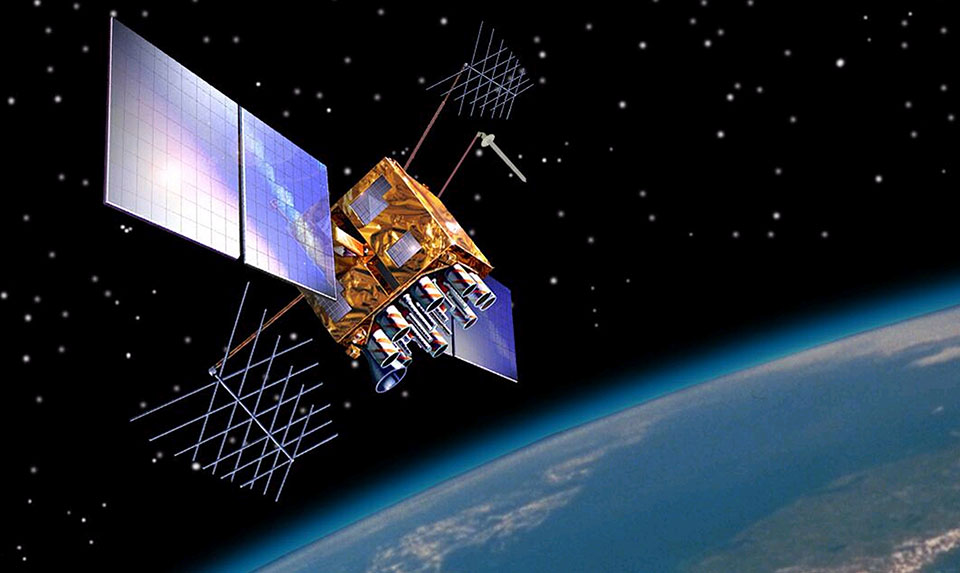
Finding your exact global position coordinates in the modern world is surprisingly easy, thanks mostly to the Global Positioning System (GPS). This incredible network of satellites, ground stations, and receivers works together to calculate your location anywhere on the planet, 24/7, in any weather conditions. The system is operated and maintained by the U.S. Space Force and is free for anyone with a GPS receiver to use.
The process, known as trilateration, works by measuring your distance from multiple satellites orbiting the Earth. At any given time, there are at least 24 GPS satellites in orbit. Your GPS receiver (like the one in your smartphone) picks up signals from these satellites. Each signal contains the satellite’s precise location and the exact time the signal was sent.
By calculating the time it takes for the signal to travel from the satellite to your receiver, the device can determine its distance from that satellite. Since the speed of the signal is constant (the speed of light), the time difference reveals the distance. To get an accurate 2D position (latitude and longitude), your receiver needs to lock onto signals from at least three satellites. For a 3D position (latitude, longitude, and altitude), it needs signals from at least four. The receiver then performs complex calculations to pinpoint your exact spot on Earth, providing you with your global position coordinates.
The Role of GPS Satellites
The GPS satellite constellation is the backbone of the entire system. These satellites are constantly orbiting the Earth at an altitude of about 12,550 miles (20,200 kilometers). They travel at speeds of around 8,700 miles per hour (14,000 kilometers per hour), completing two orbits in just under 24 hours. This orbital pattern is carefully designed so that at least four satellites are “visible” from almost any point on Earth at any time.
Each satellite carries an extremely precise atomic clock. These clocks are crucial for the timing calculations needed to determine distance. The satellites continuously broadcast their unique signal, which includes their current position, status, and the exact time the signal is sent. A GPS receiver on the ground intercepts these signals and uses the timing information to triangulate its own location. The accuracy of these global position coordinates can be affected by factors like atmospheric delays and signal blockages from buildings or mountains, but modern receivers use advanced algorithms to correct for these errors.
Other Global Navigation Satellite Systems (GNSS)
While GPS is the most well-known system, it’s not the only one. There are several other Global Navigation Satellite Systems (GNSS) operated by different countries. Many modern devices can use signals from multiple systems simultaneously, which improves accuracy and reliability.
Here’s a look at the major GNSS networks:
|
System Name |
Operating Country/Region |
Number of Satellites (Approx.) |
Status |
|---|---|---|---|
|
GPS |
United States |
31 |
Fully Operational |
|
GLONASS |
Russia |
24 |
Fully Operational |
|
Galileo |
European Union |
28 |
Fully Operational |
|
BeiDou |
China |
35+ |
Fully Operational |
|
QZSS |
Japan |
4 (Regional) |
Fully Operational |
|
IRNSS (NavIC) |
India |
7 (Regional) |
Fully Operational |
Using multiple GNSS networks at once, a receiver has access to more satellites. This is especially helpful in urban canyons or mountainous terrain where the view of the sky is obstructed. More visible satellites mean faster and more accurate positioning, leading to more reliable global position coordinates for the user.
Formats for Writing Global Position Coordinates
Once you have a set of global position coordinates, you need a standardized way to write them down. There are a few common formats, and the one you use might depend on the application or your personal preference. The key is to be consistent so that anyone (or any computer) can understand the location you’re referring to.
Let’s use the coordinates for the Empire State Building in New York City as an example to illustrate the different formats.
1. Degrees, Minutes, Seconds (DMS)
This is the most traditional format. It breaks down each degree of latitude and longitude into 60 minutes, and each minute into 60 seconds. This provides a very high level of precision.
- Format:
Degrees° Minutes' Seconds"followed by a letter indicating direction (N, S, E, W). - Example: 40° 44′ 54.3″ N, 73° 59′ 08.4″ W
This format is often used in aviation, marine navigation, and surveying, where exactness is critical. The seconds are often carried to one or more decimal places for even greater accuracy.
2. Degrees and Decimal Minutes (DDM)
This format keeps the degrees and minutes but expresses the seconds as a decimal fraction of a minute. It’s a slightly more compact way to write the coordinates and is commonly used in some GPS devices.
- Format:
Degrees° Minutes.Minutes'followed by a direction letter. - Example: 40° 44.905′ N, 73° 59.140′ W
To convert from DMS, you simply divide the seconds by 60 and add them to the minutes. In our example, 54.3″ / 60 = 0.905′. This format strikes a balance between the detail of DMS and the simplicity of DD.
3. Decimal Degrees (DD)
This is the most modern and widely used format, especially in web mapping (like Google Maps) and digital applications. It expresses the entire coordinate as a single decimal number for each latitude and longitude.
- Format: A decimal number, with positive values for North/East and negative values for South/West.
- Example: 40.748425, -73.985664
In the Decimal Degrees format, north latitudes and east longitudes are positive numbers, while south latitudes and west longitudes are negative numbers. This eliminates the need for direction letters (N, S, E, W), making the global position coordinates easier to use in computer databases and calculations. For a deeper dive into how technology shapes our world, you might find interesting articles on platforms like Forbes Planet.
Everyday Uses of Global Position Coordinates
The concept of global position coordinates might seem technical, but its applications are woven into the fabric of our daily lives. You probably use this technology dozens of times a day without even thinking about it. From finding the quickest route to work to ordering a pizza, location data is the engine running countless modern conveniences.
One of the most obvious uses is in navigation. Apps like Google Maps, Waze, and Apple Maps rely on your phone’s ability to determine its global position coordinates in real time. These apps then compare your location to vast map databases to provide turn-by-turn directions, estimate your arrival time, and even reroute you around traffic jams or accidents. This has revolutionized travel, making it easier than ever to explore new places without the fear of getting lost. It’s not just for cars either; these systems help navigate public transit, find walking paths, and plan bike routes.
From Emergency Services to Social Media
The impact of global position coordinates extends far beyond simple navigation. In emergencies, this technology is a literal lifesaver. When you dial 911 from a mobile phone, enhanced 911 (E911) systems automatically transmit your location data to the emergency dispatcher. This allows first responders—police, firefighters, and paramedics—to find you quickly, even if you don’t know or can’t say where you are. This feature has dramatically reduced response times and saved countless lives.
Here are a few other areas where this technology plays a vital role:
- Ride-Sharing and Delivery: Services like Uber, Lyft, and DoorDash depend entirely on location data. They use it to match you with the nearest driver, guide them to your pickup spot, and direct them to your destination.
- Social Media: When you “check in” at a restaurant on Facebook or add a location sticker to your Instagram story, you’re using your device’s global position coordinates.
- Fitness Tracking: Wearable devices like Apple Watches and Fitbits use GPS to track the distance and pace of your runs, walks, and bike rides, helping you monitor your fitness goals.
- Gaming: Augmented reality games like Pokémon GO use your real-world location as the game board, placing virtual creatures and items in physical spaces for you to discover.
Scientific and Industrial Applications
Beyond consumer applications, global position coordinates are indispensable tools in science and industry. Scientists use high-precision GPS to monitor tectonic plate movements, track changes in sea level, and study animal migration patterns. In agriculture, “precision farming” uses GPS-guided tractors to plant seeds, apply fertilizer, and spray pesticides with incredible accuracy. This reduces waste, lowers costs, and minimizes environmental impact.
The construction and surveying industries rely on this technology to map land, design infrastructure, and ensure buildings are constructed in the correct location. Utility companies use it to map their networks of pipes and cables, making maintenance and repairs more efficient. From managing shipping fleets to coordinating disaster relief efforts, the ability to pinpoint and share precise locations has transformed nearly every sector of the global economy.
The History Behind Our Global Grid
The idea of mapping the world with a grid system isn’t new. It dates back to ancient civilizations that sought to understand and navigate their world. The concept of latitude was understood by ancient Greek astronomers, who used the angle of the sun and stars relative to the horizon to estimate their north-south position. The Greek geographer Ptolemy, in the 2nd century AD, created one of the first world maps to use lines of latitude and longitude.
However, accurately determining longitude remained a major challenge for centuries. While latitude could be found from the stars, longitude is based on time. To know your longitude, you need to know the time at your current location and the time at a reference point (like the Prime Meridian) simultaneously. Before the invention of accurate clocks that could withstand a long sea voyage, sailors had no reliable way to measure longitude, leading to countless shipwrecks and lost voyages.
This “longitude problem” was one of the greatest scientific challenges of its era. In 1714, the British government offered a massive cash prize for a practical solution. The prize was eventually won by John Harrison, a self-taught carpenter and clockmaker. He invented the marine chronometer, a highly accurate clock that could keep precise time on a moving ship. By comparing the local time (determined by the sun’s position) with the time on the chronometer (set to Greenwich Mean Time), sailors could finally calculate their longitude and accurately determine their global position coordinates.
The Future of Positioning Technology
The world of global position coordinates and navigation technology is constantly evolving. While GPS has been the gold standard for decades, new advancements are paving the way for even more accurate, reliable, and ubiquitous positioning. The expansion of other GNSS networks like Galileo and BeiDou is creating a more robust global system. Modern receivers that can use signals from multiple constellations are less prone to errors and can get a location fix faster and in more challenging environments.
One of the biggest areas of development is improving accuracy. Standard GPS is typically accurate to within a few meters. However, techniques like Real-Time Kinematics (RTK) can enhance this accuracy down to the centimeter level. This ultra-precise positioning is unlocking new possibilities for autonomous vehicles, delivery drones, and advanced robotics that need to navigate the world with pinpoint precision.
Another exciting frontier is indoor positioning. GPS signals are weak and unreliable indoors, which is why your location dot often drifts when you’re inside a shopping mall or airport. Researchers are developing new technologies that use Wi-Fi signals, Bluetooth beacons, and even the Earth’s magnetic field to provide accurate indoor navigation. Soon, your phone might be able to guide you directly to a specific product on a supermarket shelf or to your gate in a sprawling airport terminal, extending the power of global position coordinates to the great indoors.
Conclusion
From ancient mariners staring at the stars to the complex network of satellites orbiting our planet today, the quest to define our place in the world has been a driving force of human innovation. The system of global position coordinates—the elegant grid of latitude and longitude—is the culmination of that quest. It provides a universal language for location, allowing us to navigate, communicate, and understand our world with unprecedented precision.
What began as a solution to a difficult navigational problem has blossomed into a technology that underpins our modern society. It guides our travels, protects us in emergencies, powers our economies, and connects us through shared experiences. The next time you pull up directions on your phone or see a package arrive at your door, take a moment to appreciate the invisible system of global position coordinates working silently in the background, making it all possible.
Frequently Asked Questions (FAQ)
Q1: Is there a difference between GPS and global position coordinates?
A1: Yes. Global position coordinates (latitude and longitude) are the data that defines a location. GPS (Global Positioning System) is the technology—the system of satellites and receivers—used to determine those coordinates. In other words, GPS is a tool used to find your coordinates.
Q2: How accurate are the coordinates from my smartphone?
A2: A typical smartphone can determine your location with an accuracy of about 16 feet (5 meters) under open sky. Accuracy can be reduced by tall buildings, dense forests, or being indoors. Many modern phones use signals from multiple GNSS networks (like GLONASS and Galileo) in addition to GPS, which can improve accuracy.
Q3: Can I find my global position coordinates without a GPS device?
A3: While it’s much harder, it is possible. In the Northern Hemisphere, you can estimate your latitude by measuring the angle of the North Star (Polaris) above the horizon. Determining longitude without a precise clock is extremely difficult and requires complex astronomical observations, which is why John Harrison’s chronometer was such a revolutionary invention.
Q4: Are my location coordinates private?
A4: Your location data is sensitive information. Devices and apps that use your global position coordinates have privacy settings that allow you to control when and how your location is shared. It’s important to review these settings on your phone and for individual apps to ensure you are only sharing your location when you want to.
Q5: What does it mean when coordinates are negative?
A5: In the Decimal Degrees (DD) format, negative numbers are used to indicate direction instead of letters. A negative latitude value means the location is in the Southern Hemisphere (south of the Equator). A negative longitude value means the location is in the Western Hemisphere (west of the Prime Meridian).
Stay Informed With the Latest & Most Important News
Previous Post
Next Post


Advertisement